
Zum Inhalt springen
Rubrik im Heimatguide

Touren & Wege

Wandern, Radeln, Entdecken – alle Ziele einheitlich eingeordnet, klar filterbar und direkt mit der Originalquelle verbunden.

Direkt suchen

Was passt heute zu dir?

Suche nach Ziel, Ort oder Thema. Die Ergebnisliste zeigt dir genau die Orte, die zu deinen Filtern passen – auch bei mehreren Tausend Zielen schnell und übersichtlich.

680 Ziele gefunden · Touren & Wege

Filter zurücksetzen
Hinweis zu Bewertungen

Bewertungen stammen von Google Maps. Wenn ein geprüfter Wert vorliegt, siehst du Bewertung, Anzahl und Prüfdatum direkt an der Karte. Ein Klick öffnet immer den aktuellen Stand bei Google Maps.

The Falcon Gorge and other surprises around Gohrisch – Motiv
Touren & Wege Foto: Blickwinkel Erzgebirge · Bildplatzhalter
Spa town Gohrisch/ car park Neue HauptstraßeErzgebirge

The Falcon Gorge and other surprises around Gohrisch

We reach the rocky plateau of Gohrisch through the narrow Falkenschlucht gorge, and at the top two wonderful views reward us for the effort of the ascent! The second part of the hike is a little more leisurely, with surprising things to discover near the ground.

◷ je nach Route ◇ saisonabhängig kostenlos
Google MapsÖffnen ↗ Aktuelle Bewertungen ansehenDirekt bei Google Maps Details & Planung
Alle Details +

We reach the rocky plateau of Gohrisch through the narrow Falkenschlucht gorge, and at the top two wonderful views reward us for the effort of the ascent! The second part of the hike is a little more leisurely, with surprising things to discover near the ground.

Aktuelle Öffnungszeiten, Preise und Bedingungen bitte vor dem Besuch über die verlinkte Originalquelle prüfen.

The old postal road – Motiv
Touren & Wege Foto: Blickwinkel Erzgebirge · Bildplatzhalter
BerggießhübelErzgebirge

The old postal road

The history of the Old Dresden-Teplice Postal Route goes back to the Middle Ages. In the 18th century, Augustus the Strong had the route marked with postal distance pillars. The Post Road is signposted.

◷ je nach Route ◇ saisonabhängig kostenlos
Google MapsÖffnen ↗ Aktuelle Bewertungen ansehenDirekt bei Google Maps Details & Planung
Alle Details +

The tour starts at the Haus des Gastes in the spa town of Berggießhübel. Cross the Gottleuba river and continue straight ahead onto Gersdorfer Straße. Follow this road until you reach Gersdorf itself. Shortly before entering the village, you will reach a hill with a beautiful view of the landscape. Once in the village, follow the main road and turn left towards Göppersdorf just before the post office. After a few gentle climbs, you ride comfortably between meadows and pastures. Shortly after entering Göppersdorf, turn right towards Liebstadt into Göppersdorfer Straße. The road continues uphill until you cross the motorway bridge shortly after leaving the village, from where the road leads downhill. At the next crossroads, turn right towards Liebstadt, here you can let yourself roll until you reach the turn-off for Kuckuckstein Castle. The castle gained world-historical significance…

Via the A17 to the Bahretal exit and there in the direction of Berggießhübel.

The path of inspiration – Motiv
Touren & Wege Foto: Blickwinkel Erzgebirge · Bildplatzhalter
Pirna CopitzErzgebirge

The path of inspiration

In the footsteps of Richard Wagner through Liebethaler Grund

◷ je nach Route ◇ saisonabhängig kostenlos
Google MapsÖffnen ↗ Aktuelle Bewertungen ansehenDirekt bei Google Maps Details & Planung
Alle Details +

Winter refreshment open:Romantik Hotel Deutsches HausPlatzhirsch PirnaCafé Kaffeerösterei SchmoleRestaurant Lazy Laurich

Aktuelle Öffnungszeiten, Preise und Bedingungen bitte vor dem Besuch über die verlinkte Originalquelle prüfen.
Themenweg am 1. April 2023 – Motiv
Touren & Wege Foto: Blickwinkel Erzgebirge · Bildplatzhalter
ErzgebirgeErzgebirge

Themenweg am 1. April 2023

Touren & Wege in Erzgebirge. Der Eintrag stammt aus dem regionalen touristischen Open-Data-Bestand.

◷ je nach Route ◇ saisonabhängig kostenlos
Google MapsÖffnen ↗ Aktuelle Bewertungen ansehenDirekt bei Google Maps Details & Planung
Alle Details +

Touren & Wege in Erzgebirge. Der Eintrag stammt aus dem regionalen touristischen Open-Data-Bestand.

Aktuelle Öffnungszeiten, Preise und Bedingungen bitte vor dem Besuch über die verlinkte Originalquelle prüfen.

Themenweg am 16. August 2022 – Motiv
Touren & Wege Foto: Blickwinkel Erzgebirge · Bildplatzhalter
ErzgebirgeErzgebirge

Themenweg am 16. August 2022

Touren & Wege in Erzgebirge. Der Eintrag stammt aus dem regionalen touristischen Open-Data-Bestand.

◷ je nach Route ◇ saisonabhängig kostenlos
Google MapsÖffnen ↗ Aktuelle Bewertungen ansehenDirekt bei Google Maps Details & Planung
Alle Details +

Touren & Wege in Erzgebirge. Der Eintrag stammt aus dem regionalen touristischen Open-Data-Bestand.

Aktuelle Öffnungszeiten, Preise und Bedingungen bitte vor dem Besuch über die verlinkte Originalquelle prüfen.
Altenberg (Bahnhof)Erzgebirge

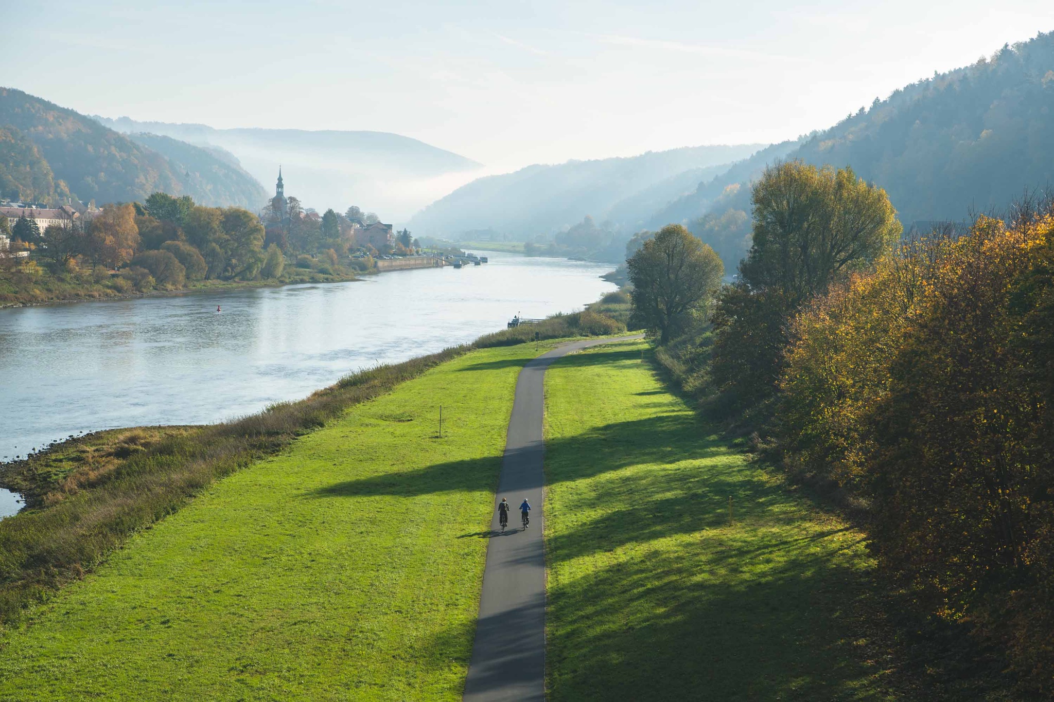
Three peaks bike tour

Three peaks in one day - one of the most popular bike tours in our Altenberg holiday region.

◷ je nach Route ◇ saisonabhängig kostenlos
Google MapsÖffnen ↗ Aktuelle Bewertungen ansehenDirekt bei Google Maps Details & Planung
Alle Details +

From Altenberg it goes over the Dippoldiswalderstrasse and the Neustadtstrasse in the direction of Geisingberg. Passing the Altenberger Pinge, through the mountain meadows you will reach the 824 m high mountain. In addition to the mountain chalet, the watchtower Louisenturm awaits you here, offering you a view of the Altenberg region. Then it goes steeply downhill towards Geising. Along the historic streets and the Hüttenteich natural pool, you ride up to the Kohlhaukuppe (786 m) - now known as the Knoblauchkuppe ( Knoblauch = garlic ) due to the garlic delicacies in the mountain hut. Along the German-Czech border (Sommerweg) you drive towards Zinnwald-Georgenfeld and cross this small mining village towards the "Lugsteine". From there, the Schneise 30 takes you to the Kahleberg - 905 m above sea level, the highest point in the Eastern Ore Mountains. Here you can enjoy breathtaking…

Über BAB17 - Abfahrt Bad Gottleuba - Lauenstein - Geising - Altenberg Über B170 - Dresden - Dippoldiswalde - Altenberg / Teplice - Dubi - Zinnwald-Georgenfeld – Altenberg

Altenberg (train station)Erzgebirge

Three peaks tour

Three peaks in one day only, this is one of the most favourite trails in the recreational area of Altenberg.

◷ je nach Route ◇ saisonabhängig kostenlos
Google MapsÖffnen ↗ Aktuelle Bewertungen ansehenDirekt bei Google Maps Details & Planung
Alle Details +

The tour starts from Altenberg from the train station. You take the Dippoldiswaldertraße and Neustadtstraße towards Geisingberg. You will walk past the Altenberg Pinge, through meadows where orchids bloom in spring, to reach the 824 m high Geisingberg. In addition to the mountain hut, you will also find the Louisenturm lookout tower at the top, which offers a panoramic view of the entire recreational area. Afterwards, you head sharply downhill in the direction of Geising. You will pass through the historic centre of Geising, then pass the natural swimming pool Hüttenteich and then climb to the Kohlhaukuppe ( 786 m above sea level ) . At the top there is a mountain hut famous for its garlic specialties and a lookout tower. You will then continue along the German-Czech border towards Zinnwald, which you will cross and head towards the Lugsteins - red-coloured rocks with a short detour…

BAB17 - Abfahrt Bad Gottleuba - Lauenstein - Geising - Altenberg B170 - Dresden - Dippoldiswalde - Altenberg / Teplice - Dubi - Zinnwald-Georgenfeld – Altenberg

Three Ponds Tour – Motiv
Touren & Wege Foto: Blickwinkel Erzgebirge · Bildplatzhalter
Bad Schandau, National Park railway stationErzgebirge

Three Ponds Tour

Our tour starts at the S-Bahn station in Bad Schandau. On the first section we cycle downstream on the Elbe cycle path to Königstein. At the roundabout in Königstein we head towards Pfaffendorf and now cycle a few metres along the Biela, which flows into the Elbe in Königstein. After about 100 m we keep to the left and follow the road, which now leads us…

◷ je nach Route ◇ saisonabhängig kostenlos
Google MapsÖffnen ↗ Aktuelle Bewertungen ansehenDirekt bei Google Maps Details & Planung
Alle Details +

Our tour starts at the S-Bahn station in Bad Schandau. On the first section we cycle downstream on the Elbe cycle path to Königstein. At the roundabout in Königstein we head towards Pfaffendorf and now cycle a few metres along the Biela, which flows into the Elbe in Königstein. After about 100 m we keep to the left and follow the road, which now leads us steeply uphill. Soon we meet the Pfaffendorfer Straße, which we follow further uphill. Now, after about 100 m, a hiking trail branches off to the right towards the Quirl table mountain. We follow the path along the edge of the forest, which leads us steeply uphill almost to the plateau of the Quirl. Afterwards, the path goes comfortably downhill for a while. Soon we meet the Kirchleitenweg, which we turn left onto. We follow this through the forest until we meet the state road towards Cunnersdorf. There we turn right, pass a forest car…

Via S-Bahn

Three Stones Route – Motiv
Touren & Wege Foto: Blickwinkel Erzgebirge · Bildplatzhalter
Bad SchandauErzgebirge

Three Stones Route

From Bad Schandau along the Kleinhennersdorfer Stein, the Papststein and the Gohrisch to Königstein.Variant 1: along below the TafelbergeVariant 2: over the Papststein and/or the Gohrisch

◷ je nach Route ◇ saisonabhängig kostenlos
Google MapsÖffnen ↗ Aktuelle Bewertungen ansehenDirekt bei Google Maps Details & Planung
Alle Details +

Winter refreshments open:Café & Bistro drehscheibe in the National Park railway station in Bad SchandauBergwirtschaft Papststein (when hiking over the Papststein!)Elbe panorama restaurant Bomätscher

Aktuelle Öffnungszeiten, Preise und Bedingungen bitte vor dem Besuch über die verlinkte Originalquelle prüfen.
Through the Bahra Valley – Motiv
Touren & Wege Foto: Blickwinkel Erzgebirge · Bildplatzhalter
BerggießhübelErzgebirge

Through the Bahra Valley

The circular tour can be started from any point. If you start in Berggießhübel, the route leads along Hellendorfer Straße, then left onto Eisenstraße, via Wemmerweg onto Bahratalstraße and further up the valley through Markersbach to Hellendorf. There you meet the Sächsische Mittelgebirge cycle route, which you follow to the left in the direction of the…

◷ je nach Route ◇ saisonabhängig kostenlos
Google MapsÖffnen ↗ Aktuelle Bewertungen ansehenDirekt bei Google Maps Details & Planung
Alle Details +

The circular tour can be started from any point. If you start in Berggießhübel, the route leads along Hellendorfer Straße, then left onto Eisenstraße, via Wemmerweg onto Bahratalstraße and further up the valley through Markersbach to Hellendorf. There you meet the Sächsische Mittelgebirge cycle route, which you follow to the left in the direction of the…

via the A17 to Bahretal and there in the direction of Bad Gottleuba-Berggießhübel

Through the Liebethaler Grund: Pirna-Liebethal – Lohmen – Dürrröhrsdorf-Dittersbach – Motiv
Touren & Wege Foto: Blickwinkel Erzgebirge · Bildplatzhalter
PirnaErzgebirge

Through the Liebethaler Grund: Pirna-Liebethal – Lohmen – Dürrröhrsdorf-Dittersbach

This hike offers two unique buildings and some views off the beaten track.

◷ je nach Route ◇ saisonabhängig kostenlos
Google MapsÖffnen ↗ Aktuelle Bewertungen ansehenDirekt bei Google Maps Details & Planung
Alle Details +

Liebethaler Grund - Malerweg (Markierung blauer Punkt) - Richard-Wagner-Denkmal - Lochmühle - Daubemühle - Lohmen "blauer Strich" - Mühlsdorf - Mühlleithe - Steinbruch - historisches Wasserwerk Niezelgrund - Weg "gelber Strich" - Weg "grüner Strich" - Ausblick - Feld entlang - Wegmarkierung "gelber Punkt" / "grüner Strich" - Breiter Stein - Eisenbahngleise überqueren - Weg nach Dürrröhrsdorf-Dittersbach - Bahnbrücke - Bahnhof

You can reach Pirna via the A4 Autobahn from the direction of Bautzen or Chemnitz to the Dresden-West junction and continue on the A17 to the Pirna junction.

Bushaltestelle Thürmsdorf / OT StruppenNationalpark Sächsische Schweiz Sachsenforst

Thürmsdorf: Zur Thiele-Aussicht

Eine bequeme, aber lohnenswerte Tour mit schöner Aussicht.

◷ je nach Route ◇ saisonabhängig kostenlos
Google MapsÖffnen ↗ Aktuelle Bewertungen ansehenDirekt bei Google Maps Details & Planung
Alle Details +

Bushaltestelle Thürmsdorf Gasthof - Thürmsdorfer Schloss - Biedermann-Mausoleum - Johann-Alexander-Thiele-Aussicht - Pehnaberg - Bushaltestelle Thürmsdorf Gasthof

Aktuelle Öffnungszeiten, Preise und Bedingungen bitte vor dem Besuch über die verlinkte Originalquelle prüfen.

To Brandaussicht – Motiv
Touren & Wege Foto: Blickwinkel Erzgebirge · Bildplatzhalter
Market HohnsteinErzgebirge

To Brandaussicht

On the balcony of Saxon Switzerland

◷ je nach Route ◇ saisonabhängig kostenlos
Google MapsÖffnen ↗ Aktuelle Bewertungen ansehenDirekt bei Google Maps Details & Planung
Alle Details +

Winter refreshment open:Brand-BaudeSat & Sun 11am - 5pmCosis Shop BistroOpen daily 7am - 5pm

Aktuelle Öffnungszeiten, Preise und Bedingungen bitte vor dem Besuch über die verlinkte Originalquelle prüfen.

To the “balcony” of Saxon Switzerland – Motiv
Touren & Wege Foto: Blickwinkel Erzgebirge · Bildplatzhalter
HohnsteinErzgebirge

To the “balcony” of Saxon Switzerland

This hiking trail will take you to the Brand viewpoint, the so-called “balcony” of Saxon Switzerland. Here, the landscape ends in a sheer drop, and you can look down into the deep Polenz Valley. The location is exposed, and views down into the canyon-like valley and into the landscape beyond are truly spectacular.

◷ je nach Route ◇ saisonabhängig kostenlos
Google MapsÖffnen ↗ Aktuelle Bewertungen ansehenDirekt bei Google Maps Details & Planung
Alle Details +

This hiking trail will take you to the Brand viewpoint, the so-called “balcony” of Saxon Switzerland. Here, the landscape ends in a sheer drop, and you can look down into the deep Polenz Valley. The location is exposed, and views down into the canyon-like valley and into the landscape beyond are truly spectacular.

Aktuelle Öffnungszeiten, Preise und Bedingungen bitte vor dem Besuch über die verlinkte Originalquelle prüfen.

To the seven ponds – Motiv
Touren & Wege Foto: Blickwinkel Erzgebirge · Bildplatzhalter
Bus stop Rosenthal, school or car park above the former Rosenthal baths.Erzgebirge

To the seven ponds

Leisurely tour where you can also learn something about the animals and plants found here.

◷ je nach Route ◇ saisonabhängig kostenlos
Google MapsÖffnen ↗ Aktuelle Bewertungen ansehenDirekt bei Google Maps Details & Planung
Alle Details +

At the beginning, the tour follows the Alte Tetschner Straße to a wooden owl. This marks the entrance to the nature trail. The plants and animals that live here are presented on display boards. The route leads up to the Schleifersberg. From there you have a wonderful view of the highest mountain in Saxon-Bohemian Switzerland, the Hoher Schneeberg. The Arnoldbank is a great picnic spot. A few steps further on, you can visit an insect hotel. The nature trail continues to the ponds. There is also a wonderful place to take a break, a covered rest area and several information boards for those who don't like to sit for too long. In summer, pretty water lilies bloom. Shortly after the ponds, the route turns off the nature trail and continues to the right on the pond path and then again to the right into the village and back to the starting point of the tour.

Aktuelle Öffnungszeiten, Preise und Bedingungen bitte vor dem Besuch über die verlinkte Originalquelle prüfen.

Market square Bad SchandauErzgebirge

Tour 1: Round trip on the Elbe Cycle Path from Bad Schandau to Schmilka

A comfortable and short round by bike along the Elbe in Bad Schandau and its villages Krippen and Schmilka.

◷ je nach Route ◇ saisonabhängig kostenlos
Google MapsÖffnen ↗ Aktuelle Bewertungen ansehenDirekt bei Google Maps Details & Planung
Alle Details +

The tour starts on the market square in Bad Schandau. It goes down to the Elbe and we first cycle downstream to the city bridge. From here you have a great panoramic view over the Elbe, the city and the rocks all around. In the other direction we see the Lilienstein, but turn in the direction of the national park train station. In loops we roll down to the Elberadweg. On the other side of the Elbe stretches the spa town of Bad Schandau and the historic passenger elevator winks in the morning light. On the left of the Elbe we follow the cycle path to Krippen, where we catch exciting perspectives with a view of the Schrammsteine. In general, you feel comfortable here between the rocks, it rolls well and the route is smooth and flat. The ferry is already waiting for us at the ferry terminal in Schmilka-Hirschmühle and will take us safely to the other bank of the river. The change of…

Aktuelle Öffnungszeiten, Preise und Bedingungen bitte vor dem Besuch über die verlinkte Originalquelle prüfen.

Tour 1: Rundtour auf dem Elberadweg von Bad Schandau nach Schmilka – Motiv
Touren & Wege Foto: Czech Vibes ↗
Marktplatz Bad SchandauNationalpark Sächsische Schweiz

Tour 1: Rundtour auf dem Elberadweg von Bad Schandau nach Schmilka

Eine gemütliche und kurze Runde mit dem Rad an der Elbe in Bad Schandau und seinen Ortsteilen Krippen und Schmilka.

◷ je nach Route ◇ saisonabhängig kostenlos
Google MapsÖffnen ↗ Aktuelle Bewertungen ansehenDirekt bei Google Maps Details & Planung
Alle Details +

Die Tour startet auf dem Marktplatz in Bad Schandau. Es geht hinunter zur Elbe und wir radeln zunächst flussabwärts bis zur Stadtbrücke. Von dieser aus hat man einen tollen Panoramablick über die Elbe, die Stadt und die Felsen rundherum. In die andere Richtung erblicken wir den Lilienstein, aber biegen in Richtung Nationalparkbahnhof ab. In Schleifen rollen wir hinab zum Elberadweg. Auf der anderen Elbseite erstreckt sich die Kurstadt Bad Schandau und im Morgenlicht blinzelt der historische Personenaufzug. Linkselbisch folgen wir dem Radweg nach Krippen, wo wir spannende Perspektiven mit Blick auf die Schrammsteine erhaschen. Generell fühlt man sich hier zwischen den Felsen wohl, es rollt gut vor sich hin und die Strecke schön flach. Am Fähranleger in Schmilka-Hirschmühle wartet die Fähre schon auf uns und bringt uns sicher ans andere Ufer. Der Perspektivwechsel, während wir über das…

Aktuelle Öffnungszeiten, Preise und Bedingungen bitte vor dem Besuch über die verlinkte Originalquelle prüfen.

Tour 2: Round trip on the Elbe Cycle Path from Bad Schandau to Wehlen – Motiv
Touren & Wege Foto: Blickwinkel Erzgebirge · Bildplatzhalter
ErzgebirgeErzgebirge

Tour 2: Round trip on the Elbe Cycle Path from Bad Schandau to Wehlen

Touren & Wege in Erzgebirge. Der Eintrag stammt aus dem regionalen touristischen Open-Data-Bestand.

◷ je nach Route ◇ saisonabhängig kostenlos
Google MapsÖffnen ↗ Aktuelle Bewertungen ansehenDirekt bei Google Maps Details & Planung
Alle Details +

Touren & Wege in Erzgebirge. Der Eintrag stammt aus dem regionalen touristischen Open-Data-Bestand.

Aktuelle Öffnungszeiten, Preise und Bedingungen bitte vor dem Besuch über die verlinkte Originalquelle prüfen.

Tour 2: Rundtour auf dem Elberadweg von Bad Schandau nach Wehlen – Motiv
Touren & Wege Foto: Blickwinkel Erzgebirge · Bildplatzhalter
Tourist Service Bad SchandauNationalpark Sächsische Schweiz

Tour 2: Rundtour auf dem Elberadweg von Bad Schandau nach Wehlen

Perfekt für den ersten Urlaubstag: Diese Kennenlernrunde auf dem Elberadweg führt in einer 8 auf knapp 34 km einmal entlang der Elbe durch die Sächsische Schweiz. Lilienstein, Festung Königstein, Bastei - die großen Highlights sind dabei im Blickfeld, genauso wie der Fluss, der unsere Region so stark prägt. Die Tour ist auch für Familien bestens geeignet.

◷ je nach Route ◇ saisonabhängig kostenlos
Google MapsÖffnen ↗ Aktuelle Bewertungen ansehenDirekt bei Google Maps Details & Planung
Alle Details +

Bad Schandau - Prossen - Halbestadt - Königstein - Kurort Rathen - Stadt Wehlen - Kurort Rathen - Königstein - Bad Schandau

Aktuelle Öffnungszeiten, Preise und Bedingungen bitte vor dem Besuch über die verlinkte Originalquelle prüfen.

Tour 3: Cycling Tour through Saxon-Bohemian Switzerland – Motiv
Touren & Wege Foto: Blickwinkel Erzgebirge · Bildplatzhalter
ErzgebirgeErzgebirge

Tour 3: Cycling Tour through Saxon-Bohemian Switzerland

Touren & Wege in Erzgebirge. Der Eintrag stammt aus dem regionalen touristischen Open-Data-Bestand.

◷ je nach Route ◇ saisonabhängig kostenlos
Google MapsÖffnen ↗ Aktuelle Bewertungen ansehenDirekt bei Google Maps Details & Planung
Alle Details +

Touren & Wege in Erzgebirge. Der Eintrag stammt aus dem regionalen touristischen Open-Data-Bestand.

Aktuelle Öffnungszeiten, Preise und Bedingungen bitte vor dem Besuch über die verlinkte Originalquelle prüfen.

Marktplatz Bad SchandauNationalpark Sächsische Schweiz

Tour 3: Radrunde durch die Sächsisch-Böhmische Schweiz

Felsenreiche Radrunde durch die Nationalparks auf beiden Seiten der Grenze.

◷ je nach Route ◇ saisonabhängig kostenlos
Google MapsÖffnen ↗ Aktuelle Bewertungen ansehenDirekt bei Google Maps Details & Planung
Alle Details +

Bad Schandau - Elberadweg - Schmilka - Hřensko - Straße nach Mezní Louka (Radroute 8 und 21) - Vysoká Lípa - Radroute 3029 - Radroute 3030 - Grüne Grenze an den Rabensteinen - Kirnitzsch-Radweg bis ins Kirnitzschtal - Kirnitzschtalstraße - Bad Schandau

Aktuelle Öffnungszeiten, Preise und Bedingungen bitte vor dem Besuch über die verlinkte Originalquelle prüfen.

Tour 4: Cycling tour from Bad Schandau through the Upper Saxon Switzerland – Motiv
Touren & Wege Foto: Blickwinkel Erzgebirge · Bildplatzhalter
ErzgebirgeErzgebirge

Tour 4: Cycling tour from Bad Schandau through the Upper Saxon Switzerland

Touren & Wege in Erzgebirge. Der Eintrag stammt aus dem regionalen touristischen Open-Data-Bestand.

◷ je nach Route ◇ saisonabhängig kostenlos
Google MapsÖffnen ↗ Aktuelle Bewertungen ansehenDirekt bei Google Maps Details & Planung
Alle Details +

Touren & Wege in Erzgebirge. Der Eintrag stammt aus dem regionalen touristischen Open-Data-Bestand.

Aktuelle Öffnungszeiten, Preise und Bedingungen bitte vor dem Besuch über die verlinkte Originalquelle prüfen.

Tour 4: Radrunde von Bad Schandau durch die Vordere Sächsische Schweiz – Motiv
Touren & Wege Foto: Blickwinkel Erzgebirge · Bildplatzhalter
Nationalpark Sächsische SchweizNationalpark Sächsische Schweiz

Tour 4: Radrunde von Bad Schandau durch die Vordere Sächsische Schweiz

Von Bad Schandau zur Bastei und nach Hohnstein: Diese Radtour durch die Vordere Sächsische Schweiz verspricht einen Abstecher zur berühmtesten Aussicht der Region, Weitblicke, Burgbesuche und die ein oder andere rasante Abfahrt.

◷ je nach Route ◇ saisonabhängig kostenlos
Google MapsÖffnen ↗ Aktuelle Bewertungen ansehenDirekt bei Google Maps Details & Planung
Alle Details +

Bad Schandau - Elberadweg - Stadt Wehlen - Wehlgrund - Rathewalde - Hohburkersdorf - Polenztal - Hohnstein - Rathmannsdorf - Bad Schandau

Aktuelle Öffnungszeiten, Preise und Bedingungen bitte vor dem Besuch über die verlinkte Originalquelle prüfen.

Tour 5: From Bad Schandau to the Pigeon Pond – Motiv
Touren & Wege Foto: Blickwinkel Erzgebirge · Bildplatzhalter
ErzgebirgeErzgebirge

Tour 5: From Bad Schandau to the Pigeon Pond

Touren & Wege in Erzgebirge. Der Eintrag stammt aus dem regionalen touristischen Open-Data-Bestand.

◷ je nach Route ◇ saisonabhängig kostenlos
Google MapsÖffnen ↗ Aktuelle Bewertungen ansehenDirekt bei Google Maps Details & Planung
Alle Details +

Touren & Wege in Erzgebirge. Der Eintrag stammt aus dem regionalen touristischen Open-Data-Bestand.

Aktuelle Öffnungszeiten, Preise und Bedingungen bitte vor dem Besuch über die verlinkte Originalquelle prüfen.